

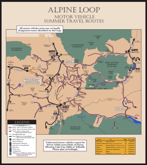
If you’re looking for an adrenaline-fueled adventure that takes you off the beaten path, look no further than the breathtaking Telluride’s 4×4 trails, Colorado.
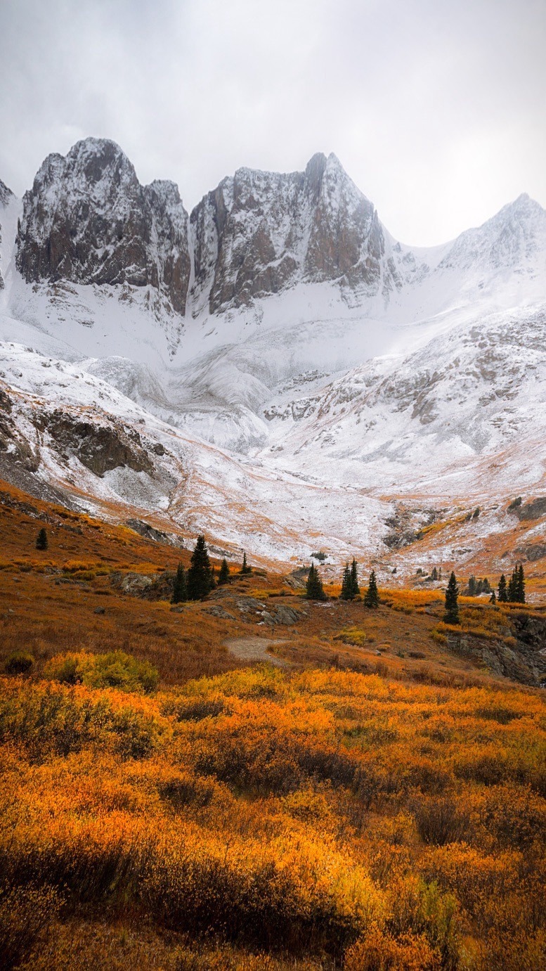
Nestled in the heart of the San Juan Mountains, Telluride boasts the most off-highway vehicle (OHV) trails above 10,000ft in the US! I’ve been 4 times and still haven’t explored them all! Autumn is my favorite time for off-roading here, as the changing colors of the leaves are breathtaking in this area, especially when paired with the jaw-dropping, snow capped mountains.
Each trail promises a unique journey filled with excitement and natural beauty. I’ve rated them here below by level of difficulty, so grab your gear and get ready to explore the wild side of Telluride, where every turn reveals a new adventure waiting to be discovered!
Imogene Pass
Difficulty Level: Difficult to Extreme, 4×4 high-clearance vehicle required! Skid-plates highly recommended.
Max Elevation: 13,114 ft
This Telluride 4×4 trail is primarily used for off-road driving (there are sections where ATV’s are not permitted and a high-clearance 4×4 vehicle is required), and is the second highest drivable road in Colorado reaching an elevation of 13,114 feet.
 Perfect for adventurers and thrill-seekers, this 17 mile point-to-point 4×4 road will give you some stunning views of the surrounding mountains. The road is steep and rocky, so it’s best suited for experienced drivers, but the panoramic views at the summit are truly rewarding. Imogene Pass stretches from Telluride to Ouray and is a great scenic route connecting these two mountain towns.
 Imogene pass closes in the winter (depending on snow conditions, October or November – June) so make sure to check the local road closures here, as well as on the San Miguel County website, especially when visiting in the fall.
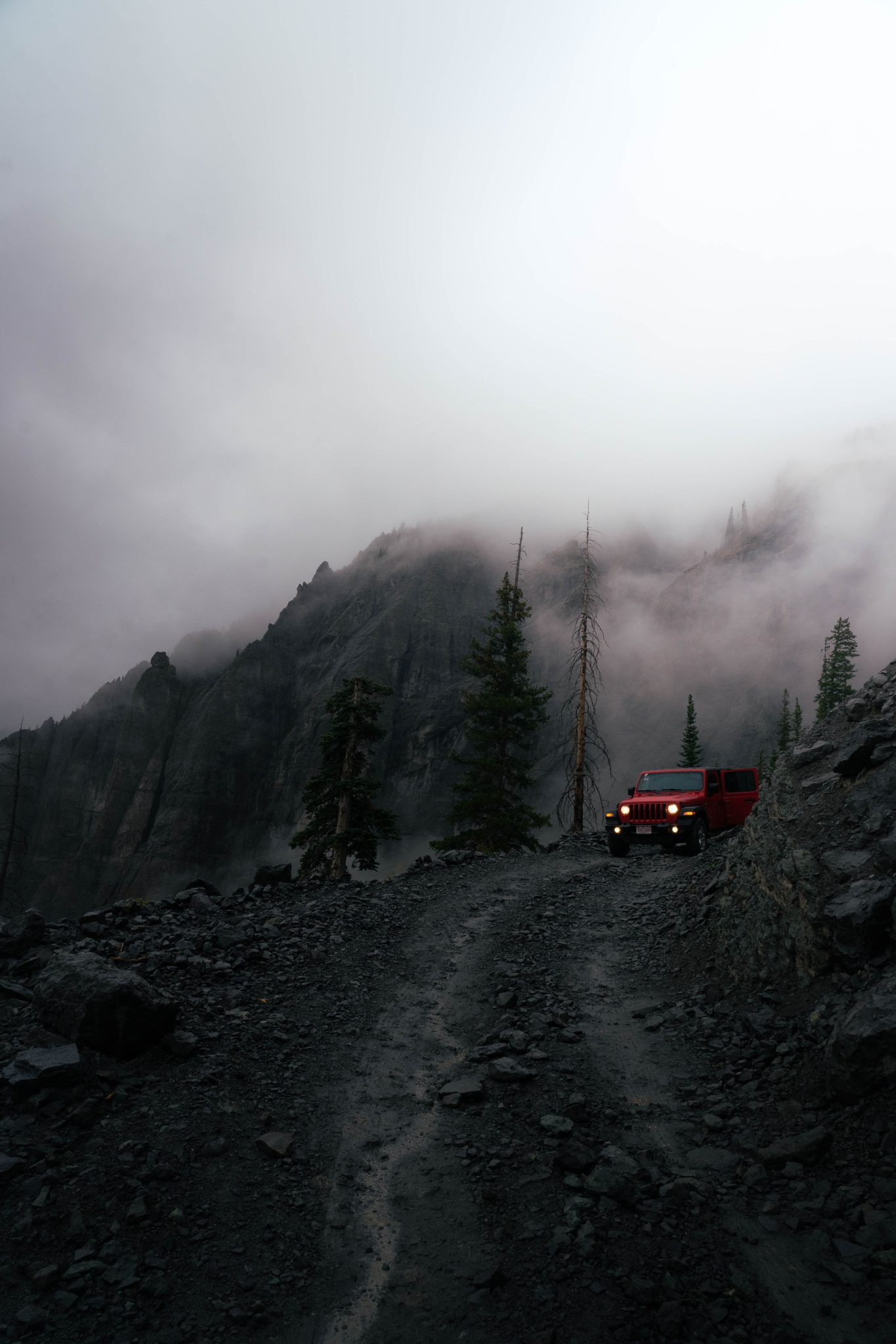
Black Bear Pass
Difficulty Level: EXPERT, high- clearance 4×4 with low-gearing ONLY
Max Elevation: 12,840 ft
View of the valley from Black Bear Pass, Telluride, Colorado
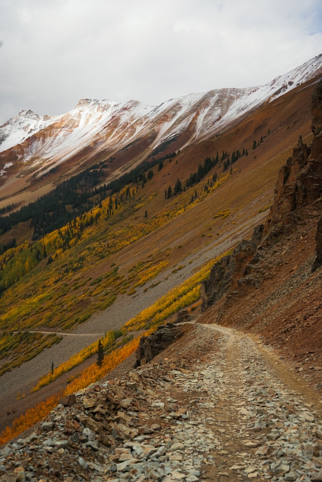
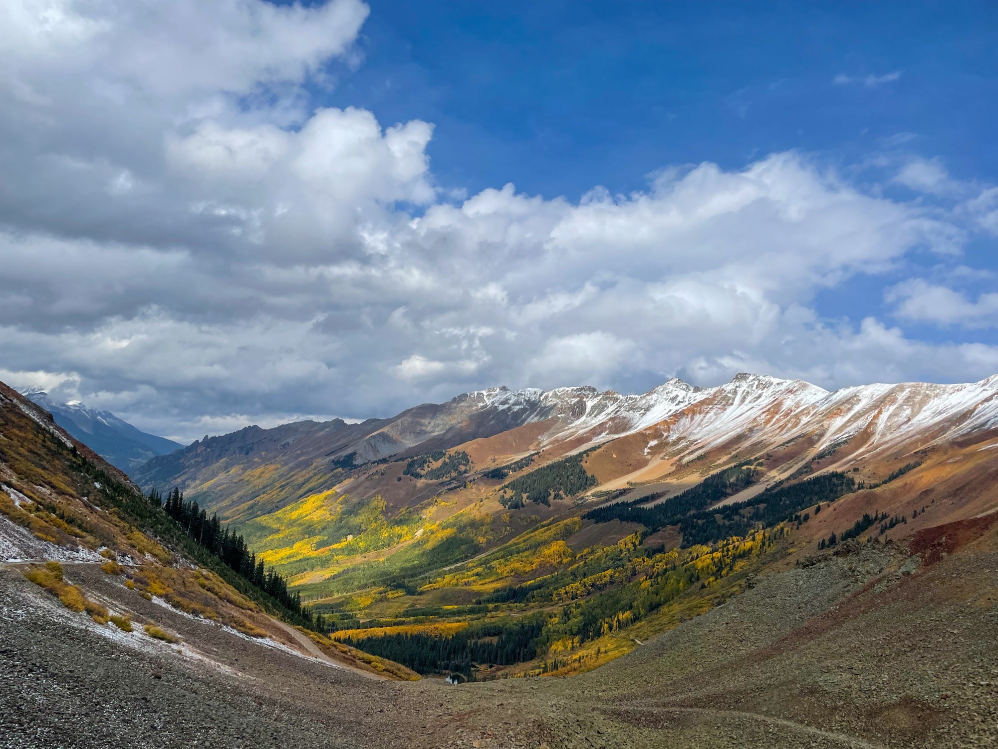
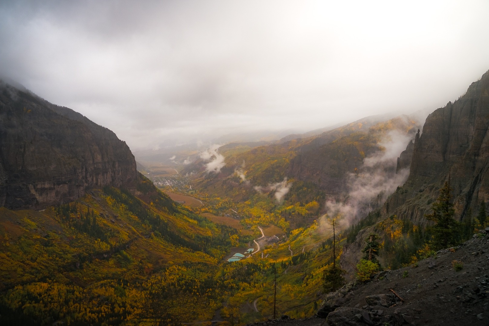
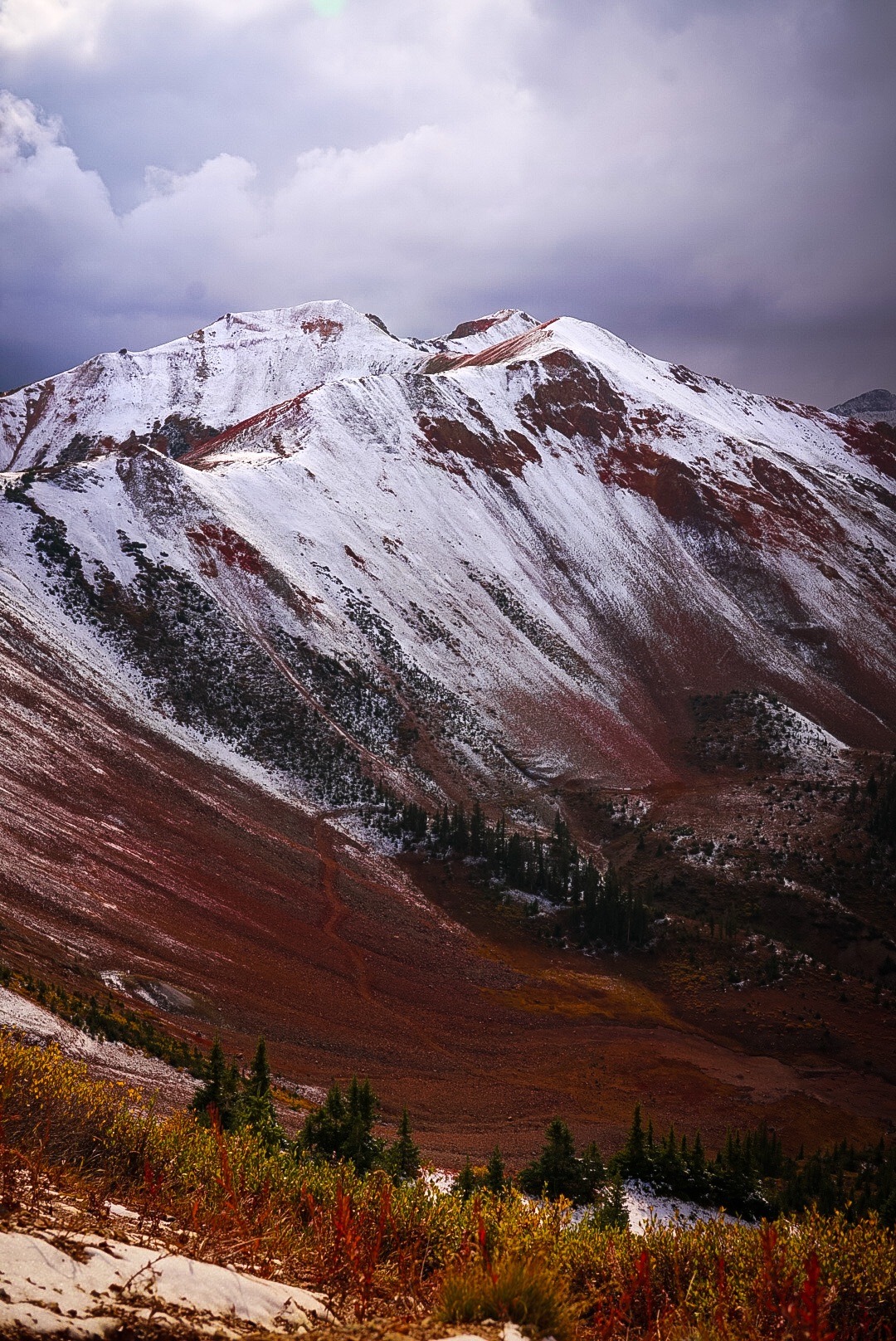
Known for its thrilling switchbacks and steep drops, Black Bear Pass is an iconic 4×4 road that offers an adrenaline-pumping adventure. The fall season enhances the experience with vibrant colors all around. The road leads to breathtaking views of the Telluride Valley and the surrounding mountains. While this route is not for the weak of spirit, the picturesque scenery and the thrill of the drive make it a must-visit for adventurous travelers. Definitely not for the faint of heart!
Heading down Black Bear Pass
Note that this section is one-way only. You can only drive down it into Telluride, not up directly from Telluride. I’d also avoid this trail in bad weather, as there are steep drop offs and very sharp, steep, narrow turns. I saw a pretty bad accident on one of my trips here; thankfully the passengers were ok but the vehicle was completely totaled. Take your time, drive slow and do not attempt this road without 4wd. And if you are feeling uncomfortable at any point driving these roads, there’s no shame in turning around! There’s so many OHV trails in the Telluride area that are easier and still have stunning views to enjoy!
Ophir Pass
Difficulty Level: Easy-Moderate; high-clearance 4×4 recommended but not required
Max Elevation: 11,789 ft
Ophir pass is relatively easy as far as Telluride’s 4×4 trails go. It meanders for 10 miles from the small town of Ophir to Red Mountain Pass and takes about 3 hours to complete. Note that 4×4 is not required for this route, but a high clearance vehicle is still recommended.  Ophir Pass is a scenic 10-mile route that provides a more relaxed drive compared to some of the other 4×4 roads in the area. The road meanders through dirt roads and loose rock/shale, and offers stunning views of the surrounding peaks. In the fall, the vibrant colors create a picturesque landscape that feels almost magical. The pass connects Telluride and Silverton, making it a great option for a day trip.
 Cinnamon Pass
 Cinnamon Pass
Difficulty Level: Moderate, 4×4 high clearance vehicle required
Max Elevation: 12,640 ft
Cinnamon Pass is a slightly more moderate 4×4 road near Telluride compared to Red Mountain Pass or Imogene Pass, with a wider road and gentler slopes, making it accessible for a broader range of vehicles. That being said, 4×4 is still required.
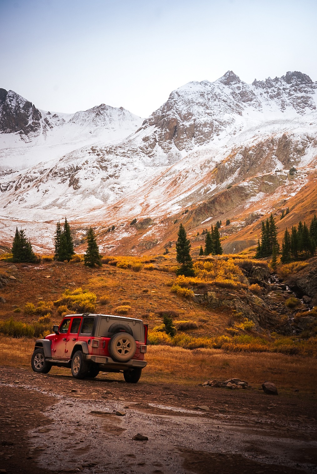
In the summer, the lush landscapes and wildflower-filled meadows along Cinnamon Pass create a picturesque setting, perfect for leisurely exploration of the San Juan Mountains. When fall arrives, expect potential fresh snow and/or icy conditions on this road. In my opinion, the snowy conditions just add a beautiful contrast to the red hues of the mountains along this section.

Reaching an elevation of 12,640 feet, Cinnamon Pass forms part of the famous Alpine Loop, connecting the towns of Lake City and Silverton. The route offers jaw-dropping views of wildflower-covered meadows, rugged ridgelines, and distant peaks that seem to stretch forever. It’s best tackled in a high-clearance 4WD vehicle, especially after rain or snow, when conditions can become slick and technical.
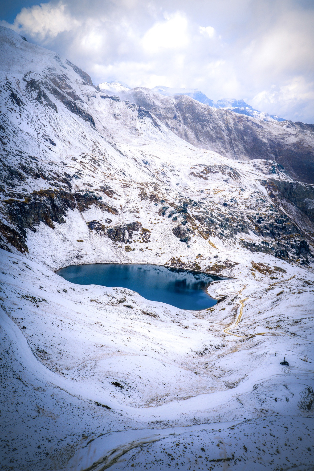 Among the most rewarding aspects of Cinnamon Pass is its access to stunning hikes and alpine lakes. One popular trail accessible from the pass is the American Basin Trail, which leads to Sloan Lake, a brilliant turquoise gem tucked beneath Handies Peak. Hikers can also summit Handies Peak itself—a 14er that’s considered one of the more approachable climbs in the region. These trails showcase some of the most pristine high-alpine landscapes Colorado has to offer and are a perfect addition to any adventure along Telluride’s 4×4 trails, even if they require a bit of a scenic detour from town.
 While Cinnamon Pass isn’t located directly in Telluride, it remains an essential destination for anyone curating a bucket-list tour of the region’s most iconic 4×4 routes. It pairs beautifully with nearby passes like Engineer and California Pass, offering a full day—or even a multi-day—loop of high-alpine exploration. For off-roaders, photographers, and hikers alike, Cinnamon Pass captures the wild beauty that defines Telluride’s 4×4 roads, making it a worthy extension to your San Juan adventure.

Red Mountain Pass
Difficulty Level: Moderate to Difficult, 4×4 highly recommended for non-paved sections
Max Elevation: 11,018 ft
Note: Technically the road through red mountain pass is paved (part of the million dollar highway), however the unpaved OHV trails and services roads require high clearance 4×4 vehicles.
Red Mountain Pass is one of the most thrilling and scenic drives in Colorado, connecting the towns of Ouray and Silverton via the famed Million Dollar Highway (U.S. Route 550). While the main road itself is paved and accessible to most vehicles, several rugged offshoots and nearby spurs turn this route into a hub for exploring Telluride’s 4×4 roads. Rising to an elevation of 11,018 feet, the pass offers hairpin turns, sheer drop-offs, and panoramic views of the vividly colored peaks that give the area its name.
 Though not a traditional off-road trail, Red Mountain Pass is a launching point for many of Telluride’s 4×4 trails, including access to Yankee Boy Basin, Black Bear Pass, and Corkscrew Gulch. These nearby routes demand a high-clearance, four-wheel-drive vehicle and reward drivers with alpine lakes, historic mining ruins, and some of the most jaw-dropping terrain in the San Juan Mountains. The dramatic elevation changes and technical sections make these trails favorites for off-roading enthusiasts seeking the ultimate alpine adventure.
 In the fall, Red Mountain Pass transforms into an explosion of color, as entire hillsides of aspen trees glow in golden hues against the deep reds and oranges of iron-rich mountains. It’s one of the best areas near Telluride to take in autumn foliage, whether you’re sticking to the main highway or venturing off into one of the many rugged 4×4 trails nearby. For thrill-seekers and photographers alike, Red Mountain Pass is a highlight among Telluride’s 4×4 roads, blending jaw-dropping beauty with a true sense of adventure.
Last Dollar Road
Difficulty Level: Moderate, 4×4 recommended (especially during wet conditions) but not required
Max Elevation: 10,600 ft
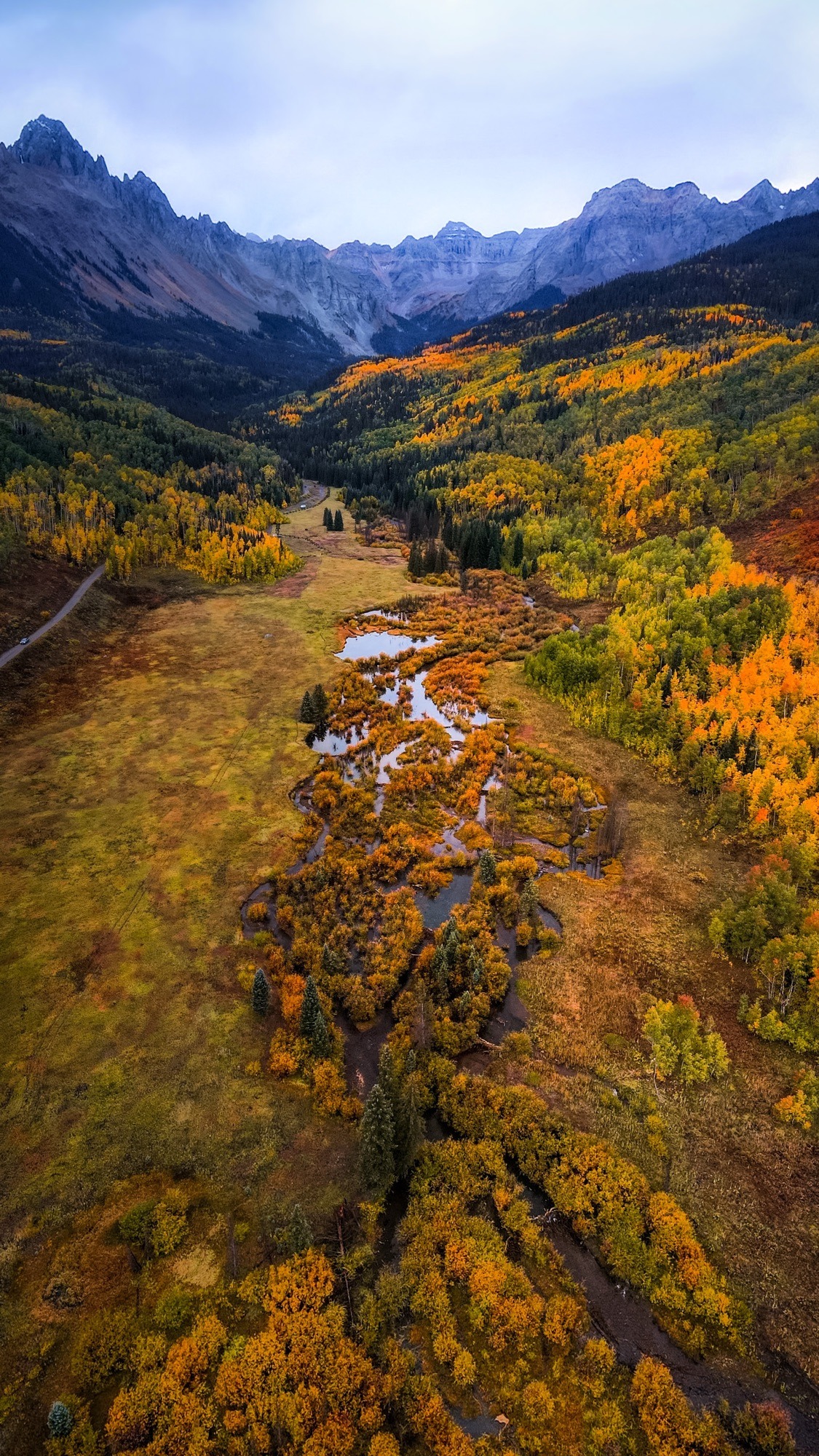
Last Dollar Road is one of the most scenic and beloved of Telluride’s 4×4 roads, offering a breathtaking drive through alpine meadows, aspen groves, and panoramic mountain vistas. Stretching roughly 18 miles between Telluride and Ridgway, this historic dirt road was once used by miners traveling to and from the region. Today, it stands as a must-do route for those looking to soak in Colorado’s natural beauty—especially in the fall, when the golden aspens turn the landscape into a glowing masterpiece of color.
 This route is considered moderate among Telluride’s 4×4 trails. While the southern portion is passable by most vehicles in dry conditions, the northern section—particularly after rain—can become muddy, rutted, and challenging, making a high-clearance, four-wheel-drive vehicle highly recommended. The road winds through sweeping ranch land, dense forest, and open ridgelines, each bend in the trail offering postcard-worthy views of the Sneffels Range and surrounding peaks.
Fall is arguably the best time to explore Last Dollar Road. As the aspens ignite in vibrant shades of yellow and orange, the already stunning drive becomes pure magic. Photographers and adventurers flock here in autumn to capture the glow of the season—often without the crowds found on more well-known routes. If you’re curating a fall road trip itinerary or exploring the best of Telluride’s 4×4 trails, Last Dollar Road absolutely belongs at the top of your list.
 In addition to the stunning scenery, Last Dollar Road provides access to various hiking trails and outdoor activities. As you venture along the road, you may encounter wildlife such as deer and elk, adding to the excitement of your journey. The fall season also brings fewer crowds, allowing for a more peaceful exploration of this beautiful area. Whether you’re looking to take in the views, capture the perfect photo, or simply enjoy a serene drive, Last Dollar Road in the fall offers a memorable adventure that showcases the best of Colorado’s natural beauty.
Owl Creek Pass
Difficulty Level: Easy, OK for conventional cars
Max Elevation: 10,114 ft
Owl Creek Pass is a hidden gem among Telluride’s 4×4 trails, especially stunning during the fall season. Winding through the San Juan Mountains, this 40-mile scenic route bursts into a vibrant display of golden aspens, rugged cliffs, and cinematic views that feel straight out of a Western movie—fittingly, since it was a filming location for True Grit. While the road is technically accessible with a 2WD vehicle, a high-clearance ride is recommended to navigate the occasional rough terrain safely, making it a great addition to your list of Telluride’s 4×4 roads to explore.
 Visiting Owl Creek Pass in autumn offers a peaceful, less-traveled alternative to Colorado’s more crowded leaf-peeping destinations. With its dramatic mountain backdrops and serene forested stretches, it’s perfect for photographers, nature lovers, and anyone seeking a tranquil fall escape. Whether you’re tackling multiple Telluride 4×4 trails or just looking for a scenic detour, this route delivers unforgettable beauty with a touch of Wild West charm.

Another notable Telluride 4×4 trail near Owl Creek Pass and Ridgeway that’s fun to explore and has some amazing views is County Road 5. This easy road meanders along Cottonwood Creek. Lined with aspens and cottonwoods, this road really shines in the fall and is excellent for leaf-peeping!
Engineer Pass
Difficulty Level: Moderate; high-clearance 4wd highly recommended
Max Elevation: 12,800 ft
Engineer Pass is one of Telluride’s most iconic 4×4 roads, carving its way through Colorado’s breathtaking San Juan Mountains. Stretching approximately 20.7 miles between the historic towns of Ouray and Lake City, this high-mountain trail typically takes about three hours to complete, depending on trail conditions and photo-worthy stops along the way. Reaching a summit of 12,800 feet, Engineer Pass rewards drivers with sweeping alpine views of dramatic 14,000-foot peaks, including Mt. Sneffels and Uncompahgre Peak—making it a must-see among Telluride’s 4×4 trails.
This rugged adventure requires a high-clearance, four-wheel-drive vehicle, especially on the western approach from U.S. Highway 550, where the trail becomes steep, rocky, and technical. As one of Telluride’s premier 4×4 roads, Engineer Pass is rich in both natural beauty and historical charm. Expect to encounter waterfalls, wildflower-filled meadows, and the remnants of old mining camps that echo the region’s frontier past. Open seasonally from late May through October, this trail offers an unforgettable off-road experience—just be sure to check current conditions before heading out.
Engineer Pass, along with Cinnamon Pass, make up the 63-mile long Alpine Loop. In the fall, the golden aspens and distant snow-capped peaks create a stunning backdrop for your adventure. The pass also offers access to several hiking trails, allowing you to explore the area further and take in the fall colors up close.
Other Notable Dirt Roads Near Telluride
County Road 7
Difficulty Level: Moderate
County Road 7, also known as East Dallas Creek Road, is a lesser-known gem among Telluride’s 4×4 roads, offering jaw-dropping views of Mt. Sneffels and the surrounding alpine wilderness. This route, which extends roughly 10 miles from Highway 62, winds through open meadows, thick aspen groves, and dramatic mountain backdrops. While the road begins relatively smooth, its condition gradually becomes rougher—making it one of those Telluride 4×4 trails best explored with a high-clearance vehicle, especially after rain or in late-season conditions.
County Rd 7
Fall transforms County Road 7 into a golden wonderland, as the aspen trees lining the route burst into vibrant yellows and oranges. Photographers capture some of the most iconic autumn shots here in the San Juan Mountains, particularly near the Sneffels Wilderness overlook. It’s a quieter, more peaceful alternative to the more trafficked scenic drives near Telluride, offering a chance to slow down and savor the changing seasons. Whether you’re out for a crisp morning drive or chasing fall color, this trail stands out among Telluride’s 4×4 roads for its serene beauty and sweeping views. County Road 7 leads up to one of my favorite trails in the area, Blue Lakes Trail, best hiked in the summer or early fall (before snow).
County Road 9
Difficulty Level: Easy to moderate depending on weather
County Road 9 does not require 4wd, however it can get very wet and muddy when it rains and even become impassable in some spots, so take note and go with your gut. If you don’t feel comfortable, or think your vehicle might get stuck, then turn around and explore some of the other beautiful OHV trails in the area!
County Road 9, also called West Dallas Creek Road, is a short but striking addition to the list of Telluride’s 4×4 trails. Branching off Highway 62 just outside Ridgway, this rugged route delivers close-up views of the Sneffels Range and the Dallas Divide with fewer crowds than other popular drives in the region. It’s an unpaved road with sections that may become muddy or uneven, so a 4WD vehicle is recommended for the best experience—especially if you’re venturing out during or after inclement weather.
In the fall, County Road 9 becomes a vivid corridor of golden aspens and dramatic light, creating a photographer’s dream. The changing foliage set against the jagged peaks of the San Juans makes this one of the most underrated fall drives among Telluride’s 4×4 roads. Although shorter in length than neighboring County Road 7 or Last Dollar Road, it offers high reward for minimal effort, especially for those looking to immerse themselves in autumn magic without straying far from town.

Always remember to check trail conditions and be prepared for changing weather, as it can impact the difficulty of these roads!
Bonus: 4-Day Telluride 4×4 Trail Itinerary
Day 1: Telluride to Ridgway via Last Dollar Road & County Roads 7 + 9
•Start: Morning departure from Telluride
•Trail 1: Last Dollar Road (18 miles) – Take in golden aspens and Sneffels Range views
•Optional: Detour for photos or picnic stops along the ranchlands
•Trail 2: From Hwy 62, drive into County Road 7 for iconic Mt. Sneffels views
•Trail 3: Loop into County Road 9 for a peaceful drive back toward Ridgway
•Overnight: Stay in Ridgway or Ouray for hot springs and dinner
⸻
Day 2: Owl Creek Pass to Silverton via Red Mountain Pass
•Trail 4: Drive Owl Creek Pass (40 miles RT) in the morning for peak fall foliage
•Scenic Drive: Return to Ridgway and head south on U.S. 550 (Million Dollar Hwy)
•Trail 5: Red Mountain Pass – Take your time soaking in high alpine views
•Optional: Short detours into Yankee Boy Basin or Corkscrew Gulch if time and weather allow
•Overnight: Silverton, a charming historic mining town
⸻
Day 3: Engineer Pass & Cinnamon Pass Loop
•Start early: Leave from Silverton or Lake City
•Trail 6: Engineer Pass (from Silverton side) – Steep, rocky, technical
•Lunch Stop: In Lake City
•Trail 7: Cinnamon Pass – Accessible route with views and hiking detours
•Optional Hike: American Basin to Sloan Lake or Handies Peak
•Loop Back: To Silverton via the Alpine Loop
•Overnight: Silverton again or camp along the loop
⸻
Day 4: Leisurely Return to Telluride
•Take the morning to explore Silverton or visit Animas Forks ghost town
•Return to Telluride via Million Dollar Highway + Dallas Divide
•If missed on Day 1, revisit Last Dollar Road in reverse for a fresh perspective
•Wrap up with dinner in Telluride and a hot shower!

Looking for more fun things to do in Telluride, or around Colorado? Explore these posts below!
What to Do in Telluride During the Summer
Hiking Colorado’s Great Sand Dunes National Park
Top 3 Sunset Hikes In Colorado Springs
Have you been to Colorado or the San Juan Mountains in the fall? If so, what was your favorite place to leaf peep? Leave a comment below!
Like this post but didn’t have time to read the whole thing? Pin on Pinterest to read later!
Safe travels always.
Sara
Did you use this blog post to plan a trip? Make sure to use the hashtag #EveryDayAVacationTrips in your social media posts so I can see! (:
